Air navigation is not limited to the actual guiding of an airplane from one place to another - it begins and ends on the ground. Before starting a cross-country flight, the pilot should plan the flight thoroughly. This includes obtaining pertinent weather information, plotting the course on an aeronautical chart, selecting checkpoints, measuring distances, and computing flight time, headings, and fuel requirements.
The first item for discussion is the aeronautical chart, inasmuch as cross-country flight is possible with this item alone, even without the magnetic compass or wind data. The type of chart recommended for VFR navigation is the Aeronautical Sectional Chart.
A course line should be drawn between the points of intended flight. This line should be dark enough to be seen, but not so heavy as to obscure the symbols on the chart. The line may be scaled off in convenient segments, such as marking every 10 miles or at each prominent checkpoint, with the distance to each recorded. This provides a convenient method of quickly determining the distance from the point of departure to any point along the course line. The angle between the course line and the meridian midway between the departure and destination can then be measured to determine the true course or direction of the flight. Meridians are the vertical lines printed on the chart that converge at the North Pole and the South Pole.
The Department of Commerce publication, Airport/Facility Directory, a valuable aid to the cross-country pilot, should be used for preflight reference. It lists all airports in the U.S. by state, city, and airport name, as well as the facilities and services available at each airport, including maintenance facilities, elevations, runway lengths, fuel grades available, etc. In addition, it includes telephone numbers for Weather Service Stations and Flight Service Stations.
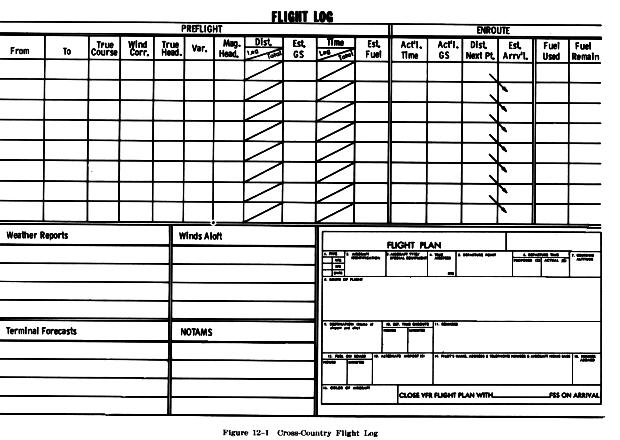
In preflight planning, accurate estimates of the time enroute (ETE) must be made to establish fuel requirements for the flight (Fig. 12-1). Estimated time of arrival (ETA) is based on the computed flying time from departure to destination. If a flight plan has been filed with the FAA, the time of departure must be reported to the local Flight Service Station (FSS) handling the flight plan. This can be done by the pilot via radio contact with the FSS after takeoff. The net enroute time should be the total flight time including any planned enroute stops of less than one hour duration between the departure and destination. The flight plan is then forwarded to the FSS nearest the intended destination.
It is extremely important for the pilot to know the fuel capacity and rate of fuel consumption of the particular airplane being used on a cross-country flight. Fuel capacity and rate of consumption can be found in the Airplane Flight Manual or the Pilot's Operating Handbook, either of which should be in the airplane at all times. The amount of fuel required and any necessary fueling stops enroute can be determined by computing the enroute time versus rate of fuel consumption. The fuel requirements are important enough for safe flight to be included in the regulations. The rules state that before beginning a day VFR flight in an airplane there must be enough fuel available to fly to the first point of intended landing and to fly after that for at least 30 minutes. When conducting a VFR night flight, the minimum fuel reserve is increased to 45 minutes.
The estimate of flying time and fuel consumption in cross-country flying is dependent upon a correct application of the airplane's speed, both airspeed and groundspeed. The indicated airspeed (IAS), as shown on the airspeed indicator, is a true value only at sea level under standard temperature conditions. At altitudes well above sea level, it is necessary to correct the IAS for the less dense air in order to determine the true airspeed (TAS). This can be done by means of an air navigation computer. The TAS, plus or minus the headwind or tailwind component respectively, equals the airplane's groundspeed.
Unless the pilot has an instrument rating, the pilot is allowed to fly cross-country only when visual flight rules (VFR) weather prevails along the route and at the destination. Basically, minimum VFR weather requires that the ceiling (height of the cloud base) be at least 1,000 feet above the surface, with at least 3 miles horizontal visibility. When flying below 10,000 feet MSL in controlled airspace, the VFR pilot must be able to remain at least 500 feet vertically below or 1,000 feet above, and 2,000 feet horizontally from the clouds. However, these are the absolute minimum requirements and are not recommended for pilots having limited experience. Much better weather conditions are advisable.
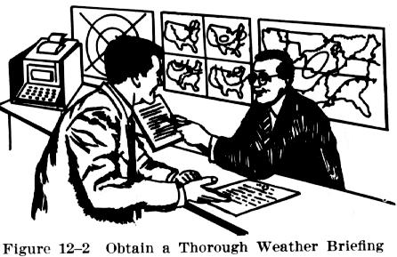
On all cross-country flights, the pilot is required by law to determine that the existing and forecast weather conditions are appropriate for the flight. Therefore, the pilot must learn to obtain, read, and understand aviation weather forecasts and reports (Fig. 12-2).
There are several types of forecasts and reports: (1) area forecasts, (2) terminal forecasts, (3) hourly sequence reports, and (4) winds aloft forecasts and reports. A thorough explanation of these is contained in the Pilot's Handbook of Aeronautical Knowledge, AC 61-23B, and the Aviation Weather Services Publication, AC 00-45A.
FAA Flight Service Stations (FSS) have prime responsibility for preflight pilot briefing, enroute communications with VFR flights, assisting lost VFR aircraft, broadcasting aviation weather information, accepting and closing flight plans, and operating the weather teletypewriter systems. In addition, FSSs take local weather observations and issue airport advisories.
The pilot should always consult the local Flight Service Stations (FSS), or National Weather Service Office (NWSO) for preflight weather briefing. FSS and NWSO personnel are certificated pilot weather briefers and thoroughly understand the weather needs of pilots.
When telephoning for information, the pilot should use the following procedure:
a. Identify oneself as a pilot. (Many persons calling Weather Service Stations want information for purposes other than flying.)
b. State the intended route, destination, proposed departure time and estimated time enroute.
c. Advise if intending to fly only VFR.
d. State the airplane type and identification.
It is the pilot's responsibility to determine that the airplane is properly certificated and airworthy. There must be displayed in the airplane a registration certificate showing the name of the registered owner, and an airworthiness certificate for the airplane. In addition, the pilot should have available an operations limitations record or airplane flight manual which shows maximum loading conditions of the airplane, allowable speeds, performance capabilities, etc.
Upon selecting the aeronautical charts to be used for the flight, it is important to check their dates of issue to make certain they are current. Prior to takeoff, the charts should be folded in a manner that will allow easy reading in flight without having to unfold or refold the rather large, cumbersome sheets.
On cross-country flights, inexperience and lackadaisical pilots often allow the cockpit to look like a shambles with charts scattered all over the floor, drop the one and only pencil under the seat, and permit the navigation computer to slide to the back of the airplane. Good "cockpit management" is essential to a pleasant, efficient flight just as it is for experienced pilots who conduct their flights in a professional manner.
"A place for everything and everything in its place" is a wise saying which certainly has true meaning in the conduct of a well executed cross-country flight. Thorough preflight planning, plus efficient cockpit management, contribute substantially to safe and efficient flight.
The charts should be organized in proper sequence according to their order of use. They should be put in a special place away from other charts that definitely won't be used. How to keep charts from falling off the pilot's lap is one thing some pilots have never solved. Laps just aren't big enough, have round edges and lead to everything falling on the floor - and usually out of reach. However, while the top of the instrument panel appears tempting as a storage area, the area should never be used in flight for charts or other equipment.
The pilot should establish a definite, convenient storage
place for pencil, navigation computer, flight log, and note pad. After
each time they are used, they should be put back where they belong - not
loosely on the lap. Rubber bands, clips, clipboard, or a pad that can be
strapped to the pilot's leg are useful in holding the needed items in place.