![]()
|
|
||
| CHAPTER 5. Information Systems
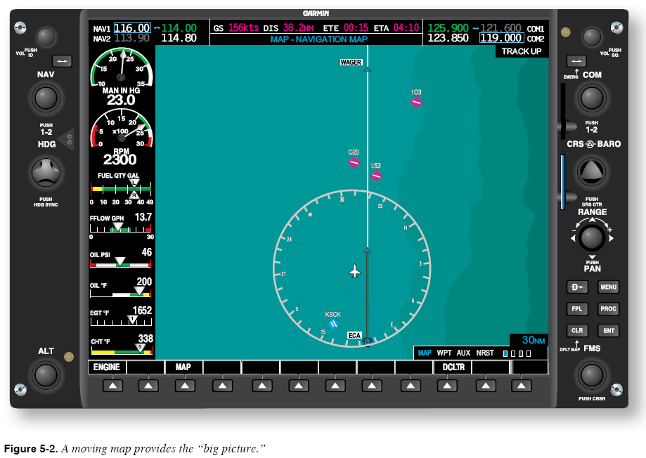
Maintaining the “Big Picture” Moving map displays can help you verify a basic understanding of the planned route and aircraft position with respect to the route, nearby terrain, and upcoming waypoints. For example, the moving map display in Figure 5-2 shows the aircraft slightly to the left of the programmed flight route, presumably heading in the correct direction, and operating to the west of rising terrain.
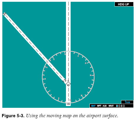
Maintaining Awareness of Potential Landing Sites The moving map in Figure 5-2 makes several nearby alternative airports visually apparent. A classic technique used by pilots to maintain awareness is to periodically ask the question, “Where would I go if I lost engine power?” The moving map can be used in this way to maintain preparedness for an emergency, if you are aware of the map scale and aircraft capabilities. Maintaining Awareness on the Airport Surface On most units, you can change the range on the moving map to see a more detailed picture of the airport surface while operating on the ground. This feature is especially useful when the arrangement of runways and taxiways is complex. The moving map in Figure 5-3 shows the aircraft prepared to taxi onto one of two possible runways.
Identifying Controlled Airspace Most moving map displays can portray surrounding airspace as well as the vertical limits of each airspace segment. This feature is particularly useful during visual flight rules (VFR) flights, but can also serve to remind you of speed restrictions that apply to airspace transitions during instrument flight rules (IFR) flight. |
| ©AvStop Online Magazine Contact Us Return To Books |