|
|
| INSTRUMENT PROCEDURES HANDBOOK |
|
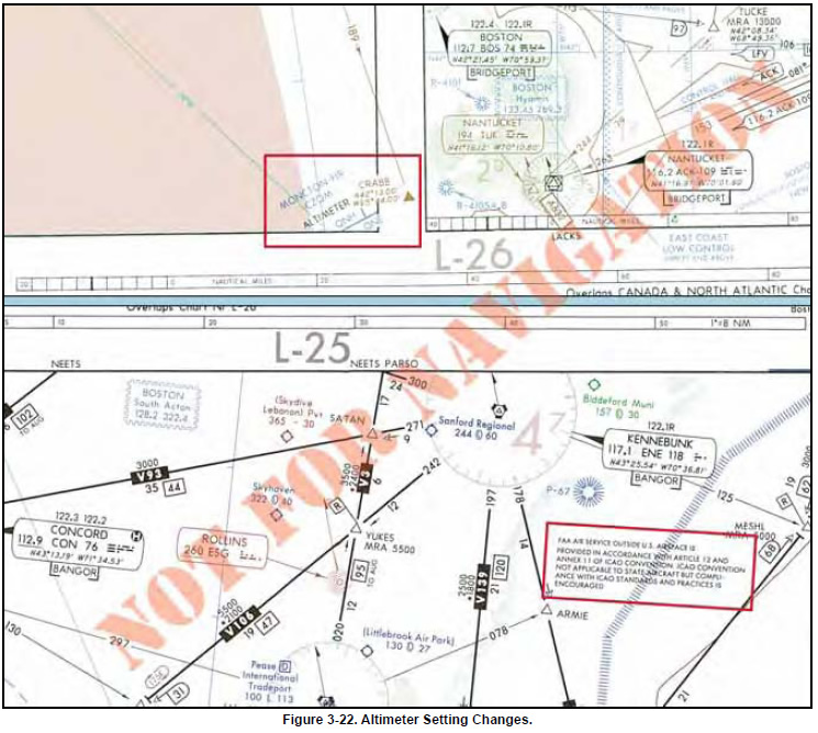
When flight crews transition from the U.S. NAS to
another country’s airspace, they should be aware of differences
not only in procedures but also airspace. For
example, when flying into Canada regarding altimeter
setting changes, as depicted in Figure 3-22 on page 3-18,
notice the change from QNE to QNH when flying northbound
into the Moncton flight information region
(FIR), an airspace of defined dimensions where flight
information service and alerting service are provided.
Transition altitude (QNH) is the altitude in the vicinity
of an airport at or below which the vertical position of
the aircraft is controlled by reference to altitudes (MSL).
The transition level (QNE) is the lowest flight level
available for use above the transition altitude. Transition
height (QFE) is the height in the vicinity of an airport at
or below which the vertical position of the aircraft is
expressed in height above the airport reference datum.
The transition layer is the airspace between the transition
altitude and the transition level. If descending
through the transition layer, set the altimeter to local station
pressure. When departing and climbing through the
transition layer, use the standard altimeter setting (QNE)
of 29.92 inches of Mercury, 1013.2 millibars, or 1013.2
hectopascals. Remember that most pressure altimeters
are subject to mechanical, elastic, temperature, and
installation errors. Extreme cold temperature differences
also may require a correction factor.
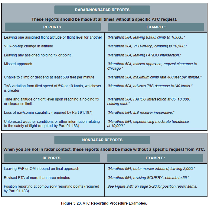
In addition to acknowledging a handoff to another Center en route controller, there are reports that should be made without a specific request from ATC. Certain reports should be made at all times regardless of whether a flight is in radar contact with ATC, while others are necessary only if radar contact has been lost or terminated. Refer to Figure 3-23 on page 3-19 for a review of these reports.
|