|
|
| INSTRUMENT PROCEDURES HANDBOOK |
|
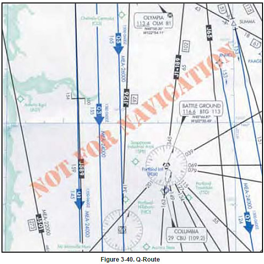
Naturally, the routes between some points are very
popular, so these paths are given route designators and
published on charts. The U.S. and Canada use "Q" as
a designator for RNAV routes. Q-Routes 1 through
499 are allocated to the U.S., while Canada is allocated
Q-Routes numbered from 500 through 999. The
first Q-Routes were published in 2003. One benefit of
this system is that aircraft with RNAV or RNP capability
can fly safely along closely spaced parallel
flight paths on high-density routes, which eases airspace
congestion. While the initial overall HAR
implementation will be at FL390 and above, some of
the features may be used at lower altitudes, and some
Q-Routes may be used as low as FL180. A Q-Route is
shown in figure 3-40.
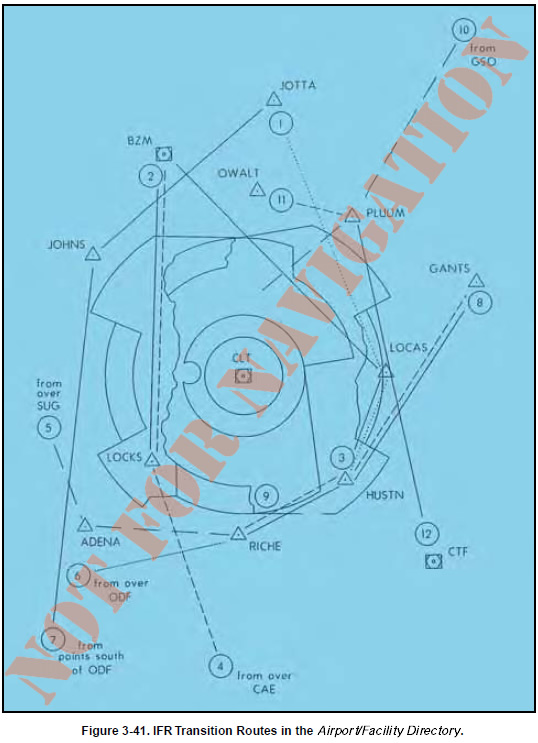
The NRS is a grid of waypoints overlying the U.S. that will be the basis for flight plan filing and operations in the redesigned high altitude environment. It will provide increased flexibility to aircraft operators and controllers. The NRS supports flight planning in a NRR environment and provides ATC with the ability to more efficiently manage tactical route changes for aircraft separation, traffic flow management, and weather avoidance. It provides navigation reference waypoints that pilots can use in requesting route deviations around weather areas, which will improve common understand understanding between pilots and ATC of the desired flight path. The NRS will initially include waypoints every 30 minutes of latitude and every two degrees of longitude. In its final version, the NRS waypoints will have a grid resolution of 1-degree longitude by 10 minutes of latitude. As database capabilities for the preponderance of aircraft operating in the high altitude airspace environment becomes adequate to support more dense NRS resolution, additional NRS waypoints will be established. T-Routes are being created for those who operate at lower altitudes. T-Routes have characteristics that are similar to Q-Routes, but they are depicted on low altitude en route charts and are intended for flights below FL180. The first T-Routes are being pioneered in Alaska. In order to expedite the handling of IFR overflight traffic through Charlotte Approach Control Airspace, several RNAV routes are published in the Airport/Facility Directory and available for you when filing your flight plan. Any RNAV capable aircraft filing flight plan equipment codes of /E, /F, or /G may file for these routes. Other aircraft may request vectors along these routes but should only expect vector routes as workload permits. Altitudes are assigned by ATC based upon traffic. [Figure 3-41]
|