AIRCRAFT COMMUNICATIONS
ADDRESSING AND REPORTING SYSTEM
Of course, pilot-controller communication is compromised
when the crew is listening to other frequencies or
engaged in other communications, such as talking to
their company. If these communications could be
accomplished silently and digitally, voice communications
with ATC would improve. The Aircraft
Communications Addressing and Reporting System
(ACARS) is a commercial system that enables the crew
to communicate with company personnel on the ground.
It is often used to exchange routine flight status messages,
weather information, and can serve as a non-voice
communication channel in the event of an emergency.
Many of the messages are sent and received automatically,
such as the time the flight leaves the gate
(triggered by the release of the parking brake), takeoff
and touchdown times (triggered by landing gear
switches), and arrival time (triggered when a cabin
door is opened). Other information may include
flight plans, significant meteorological information
(SIGMETs), crew lists, cargo manifests, automatic
terminal information service (ATIS) reports, en
route and destination weather, clearances, and fuel
reports. Some ACARS units can interface with
onboard engine and performance-monitoring systems
to inform company ground personnel of maintenance
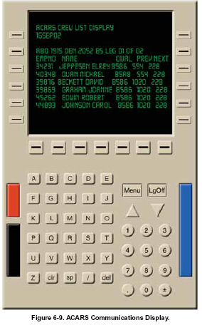
or operations related issues. [Figure 6-9]
Significant valuable meteorological data can be obtained
by collecting data from aircraft fitted with appropriate
software packages. To date, the predominant sources of
automated aviation data have been from aircraft
equipped with aircraft to satellite data relay (ASDAR)
and ACARS, which routes data back via general purpose
information processing and transmitting systems now
fitted to many commercial aircraft. These systems offer
the potential for a vast increase in the provision of aircraft
observations of wind and temperature. Making an
increasingly important contribution to the observational
database, it is envisioned that ACARS data will
inevitably supersede manual pilot reports (PIREPS).
Another use of ACARS is in conjunction with Digital
ATIS (D-ATIS), which provides an automated process
for the assembly and transmission of ATIS messages.
ACARS enables audio messages to be displayed in text
form in the flight decks of aircraft equipped with
ACARS. A printout is also provided if the aircraft is
equipped with an on-board printer. D-ATIS is operational
at over 57 airports that now have pre-departure
clearance (PDC) capability.
AUTOMATIC DEPENDENT
SURVEILLANCE-BROADCAST
 Unlike TCAS and terrain awareness and warning systems
(TAWS), which have been used in airline and military
aircraft
for at least a decade, ADS-B is a relatively new air
traffic technology. It is an onboard system that uses Mode
S transponder technology to periodically broadcast an aircraft’s
position, along with some supporting information
like aircraft identification and short-term intent. By picking
up broadcast position information on the ground
instead of using ground radar stations, ADS-B represents
a significant advancement over the existing ATC system
by providing increased accuracy and safety. This is possible
because ADS-B addresses the major deficiency of
TCAS - accuracy. In the TCAS system, aircraft positions
are only accurate to a few degrees; thus, the accuracy of
TCAS decreases with distance. Moreover, the reliance on
transmission timing for range data in TCAS is errorprone.
The method used by ADS-B avoids this problem. Unlike TCAS and terrain awareness and warning systems
(TAWS), which have been used in airline and military
aircraft
for at least a decade, ADS-B is a relatively new air
traffic technology. It is an onboard system that uses Mode
S transponder technology to periodically broadcast an aircraft’s
position, along with some supporting information
like aircraft identification and short-term intent. By picking
up broadcast position information on the ground
instead of using ground radar stations, ADS-B represents
a significant advancement over the existing ATC system
by providing increased accuracy and safety. This is possible
because ADS-B addresses the major deficiency of
TCAS - accuracy. In the TCAS system, aircraft positions
are only accurate to a few degrees; thus, the accuracy of
TCAS decreases with distance. Moreover, the reliance on
transmission timing for range data in TCAS is errorprone.
The method used by ADS-B avoids this problem.
In addition to the broadcast of position to the ground,
ADS-B can be used to enable a new collection of aircraft-
based applications. Unlike conventional radar,
ADS-B works at low altitudes and on the ground. It is
effective in remote areas or in mountainous terrain
where there is no radar coverage, or where radar coverage
is limited. One of the greatest benefits of ADS-B isits ability to provide the same real-time information to
pilots in the aircraft cockpit and to ground controllers,
so that for the first time, both can view the same data.
ADS-B will also enable aircraft to send messages to
each other to provide surveillance and collision avoidance
through data link. Other aircraft in the immediate
vicinity can pick up position information broadcasts
from equipped aircraft. This enables equipped aircraft to
formulate a display of nearby aircraft for the pilot; the
pilot’s awareness of the current situation is enhanced.
Combined with databases of current maps and charts,
the onboard displays can show terrain as well as proximate
aircraft. This is a powerful inducement for change.
The heightened situational awareness offered by satellite
navigation in conjunction with modern database
applications and map displays, combined with the position
of proximate aircraft, builds a picture in the cockpit
equivalent to that on the ground used by the controller.
This is particularly important in places like Alaska
where aviation is vital, NAS infrastructure is minimal
(because of the harsh conditions), and weather changes
quickly and in unpredictable fashions.
Eventually, as the fleets equip, it may be possible to save
money by retiring expensive long-range radars.
Identified by the FAA as the future model for ATC,
ADS-B is a major step in the direction of free flight.
While ADS-B shows great promise for both air-to-air
and air-to-ground surveillance, current aircraft transponders
will continue to support surveillance operations in
the NAS for the foreseeable future. If enough users
equip with ADS-B avionics, the FAA will install a
compatible ADS ground system to provide more accurate
surveillance information to ATC compared to
radar-based surveillance.
In the United States, two different data links have been
adopted for use with ADS-B: 1090 MHz Extended
Squitter (1090 ES) and the Universal Access Transceiver
(UAT). The 1090 ES link is intended for aircraft that primarily
operate at FL180 and above, whereas the UAT
link is intended for use by aircraft that primarily operate
at 18,000 feet and below. From a pilot's standpoint, the
two links operate similarly and both support ADS-B and
TIS-B. The UAT link additionally supports Flight
Information Service-Broadcast (FIS-B) at any altitude
when within ground based transmitter (GBT) coverage.
FIS-B is the weather information component, and
provides displays of graphical and textual weather
information. Areas of approved use for the UAT
include the United States (including oceanic airspace
where air traffic services are provided), Guam, Puerto
Rico, American Samoa, and the U.S. Virgin Islands.
The UAT is approved for both air and airport surface
use. ADS-B broadcast over the 1090 MHz data link
has been approved for global use. |
